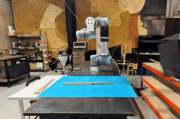
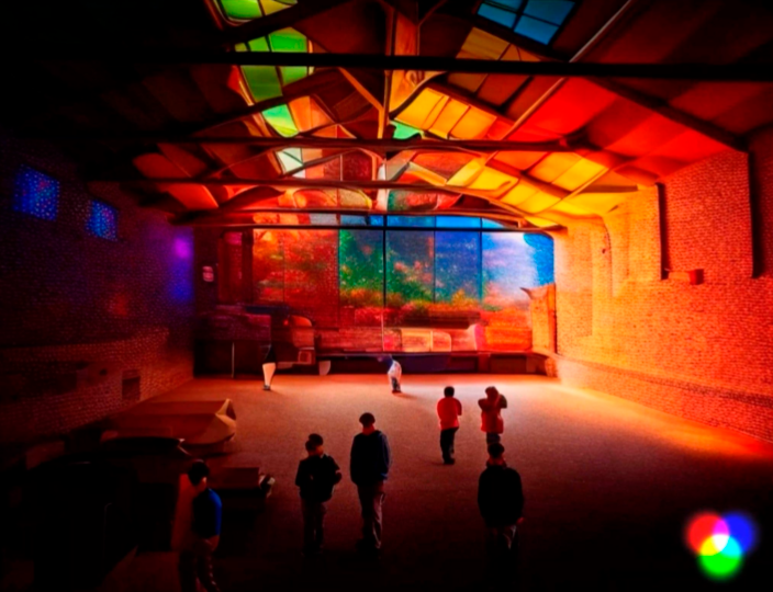
Superblock BCN

A Multidimensional Study of the Superilla My research starts from observing human behaviour. Often when we face a change in our lives, especially when it wasn’t planned, we feel resistance and it takes time before we accept and embrace it.  As you probably know Barcelona in the last few years lived some changes in its … Read more

FireFly

Harnessing the power of drone-based photogrammetry and artificial intelligence to create a low-cost urban wildfire diagnostic tool. In recent years, the global community has witnessed a significant upsurge in the frequency and intensity of wildfires. Driven by a combination of climate change, urban expansion, and land-use practices, these fires have not only devastated vast natural … Read more

Xelajú-Digerible

El sistema alimentario como pilar estratégico para el desarrollo urbano de la zona 3, Quetzaltenango. Quetzaltenango, Guatemala. C.A El enfoque anteriormente abordado se centraba en la ecología y el cambio climático, exponiendo la situación actual de la ciudad de Quetzaltenango. Se identificaban los procesos alimentarios a través de la industria y cómo estas dinámicas contribuyen … Read more

TERRITORIOS REACTIVOS. Hacia una reprogramación de la región centro-sur de Uruguay

Territorios reactivos refiere a la activación del territorio como respuesta a la irrupción del Proyecto Ferrocarril Central, obra de rehabilitación de 273km de la infraestructura ferroviaria histórica de Uruguay que al 2023 se encuentra en obra 1. Antigua red ferroviaria La vía férrea, uno de los elementos más representativos de la primera revolución industrial, comienza … Read more

Environmental Asset Resilience

The Environmental Asset Resilience (EAR) Tool is a response to the pressing global challenge of environmental instability, particularly in urban areas. These areas face substantial costs associated with environmental problems and climate change. However, decision-making in addressing these issues is complicated by conflicting priorities, limited resources, and a lack of expertise. The EAR Project aims … Read more

Urban Dynamic Lights

Urban Dynamic Lighting is a research conducted on dynamic lighting for cities, exploring its transformative power and the possibilities it holds for cities worldwide. The study presents a comprehensive framework for implementing dynamic lighting systems on an urban scale. The power of dynamism Dynamicity represents a paradigm shift in our perception of cities. It recognizes … Read more

Beyond Corals

The world’s coral reefs face significant threats due to rising ocean temperatures. They play a critical role in supporting biodiversity, providing habitats for marine species, and acting as natural barriers against storms and erosion. However, coral bleaching caused by the rising ocean temperatures are causing substantial risks to their survival. Efforts to address these challenges … Read more

Loneliness in Greater Melbourne

There are different types of loneliness and different causes for each type. The social media induced loneliness as described by Sherry Turkle in her book Alone Together: Why We Expect More from Technology and Less from Each Other (2012) is different from the loneliness of feeling alone in a crowd in a very large city … Read more

Wildlife Corridors

Our project focuses on modeling and predicting habitat fragmentation avoidance mechanisms using graphs. We investigate wildlife corridors in Australia, leveraging graph-based approaches to create coherent passages and connect forest areas. By analyzing satellite images, road data, and other metrics, we construct and evaluate graph models that incorporate forest containment, node characteristics, and connectivity. Our goal … Read more

Airports as Graphs

Introduction: Airports, intricate systems encompassing numerous services and pathways within sprawling infrastructures, face the challenge of optimizing the flow towards departure gates. In this study, we delved into the possibility of filtering out non-essential activities and prioritizing efficient movement within airports. To gain insights, we focused on Oslo Gardermoen airport, a moderate-sized airport with a … Read more

SKYWARD CONNECTIONS

A Data-driven Approach of redefining the Accessibility of the Dispersed Urbanity of the Aegean Archipelago Accessibility is a multifaceted concept that expresses the case of access between two points in space. In the context of islands, accessibility is of utmost importance due to their inherent characteristics of isolation and small size. The Aegean Archipelago in … Read more

Mississippi 2102

Meanders on the Lower Mississippi River In the battle between architecture and nature, nature tends to win. Therefore, it is important that we understand how rivers move over time so that we can know the best and the worst places to build. Our project studies the Lower Mississippi River from Cairo, Illinois to New Orleans, … Read more

GENDERED GEOGRAPHIES

Navigating Urban Realities through Women’s Perception of Safety Cities all over the world are being quantified and rated in terms of their livability and life quality for better understanding of citizen satisfaction.  Safety, including both the tangible aspects and the subjective perception of safety, is a critical component in assessing urban life quality. According to … Read more

Compath

Problem statement and project objectives How can we create a routing system that orients onto its users environment, utilizing open source data? How do we collect and process data? Our objective is to utilize the existing data and generate any missing data required for each aspect of our analysis.  We combine data from different sources … Read more

The 3-30-300 Rule

TRANSFORMING CITIES INTO URBAN FORESTS This principle, proposed by Cecil Konijnendijk, highlights the significant role played by urban forests and other forms of urban nature in promoting our health, well-being, and resilience to climate change. It acknowledges the need to consider various aspects of urban forests to achieve success. It also emphasizes the importance of … Read more