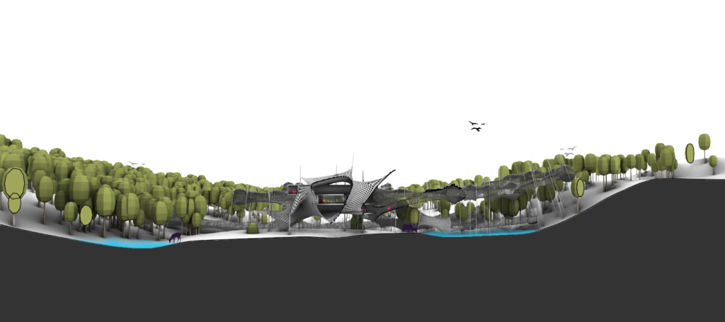
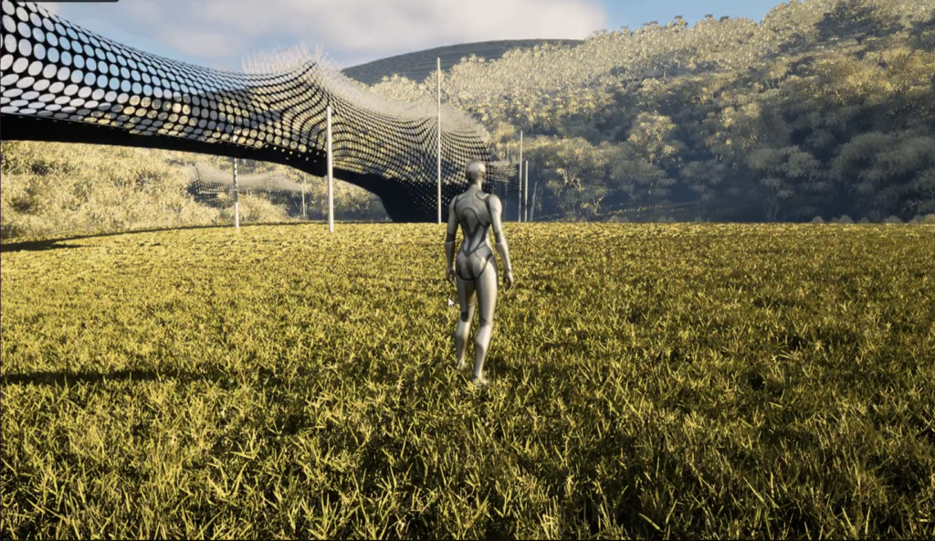
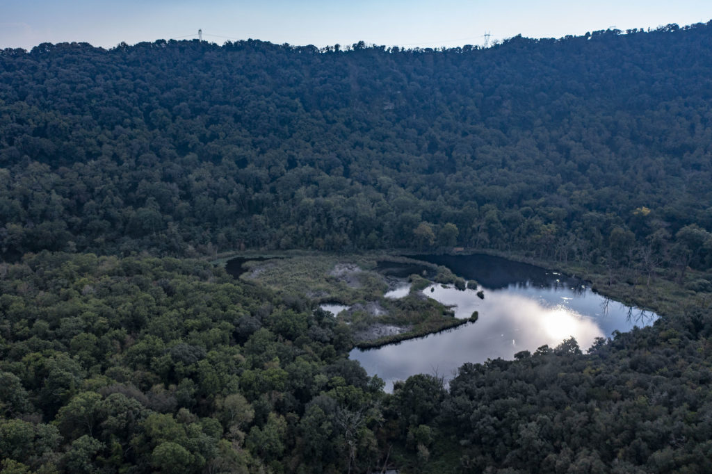
Spanning across an expansive natural sanctuary in Pozzuoli, Italy, the site for our study was equally challenging and interesting. The valley-like topography was crowned by a lake in the middle. The programme of imagining a wildlife museum at this site prompted us to think outside the box, to incur minimum impact on the site while amplifying the experience of the users. Our intervention had to be visually and physically non-abrasive but still encapsulate the expansive site, with all its different flavors and nuances.
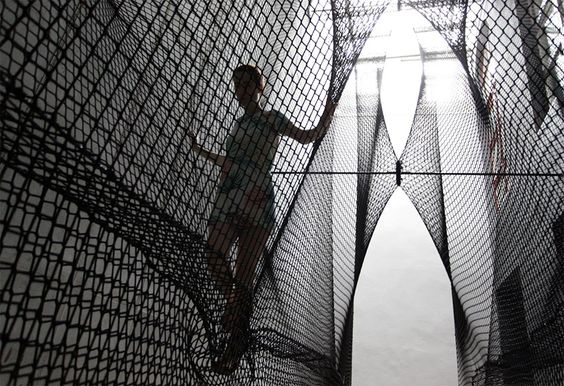
While brainstorming we put together a wordcloud to represent our ethos for this intervention. It included ideas like; Temporal, Flexible, Invisible, Immersive, and Fluid. This helped us establish that fabric/ tensile mesh would best mirror our take on the site, moving away from the conventional tectonics and enclosures. We envisioned that the tensile nature of a fabric mesh could be deployed to create “stretch: a space out that lets the user experience the site and nature as the object on display, switching the roles of exhibition space.
For us, the curation of experience was in the arrangement of the journey of delving into nature and not the aesthetic of a spatial enclosure. Mapping the journey became the center of inquiry for us. For this, we formulated a systematic approach with controlled variables to map out possible journeys.
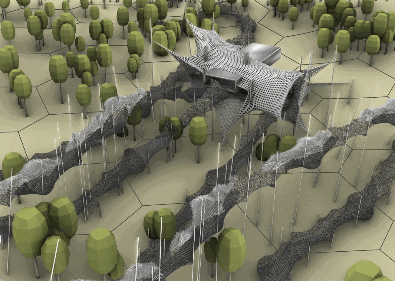
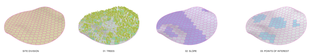
Step 01: Scoring the Site
We set out to deconstruct the site into a hex grid and then score each cell based on the following criteria:
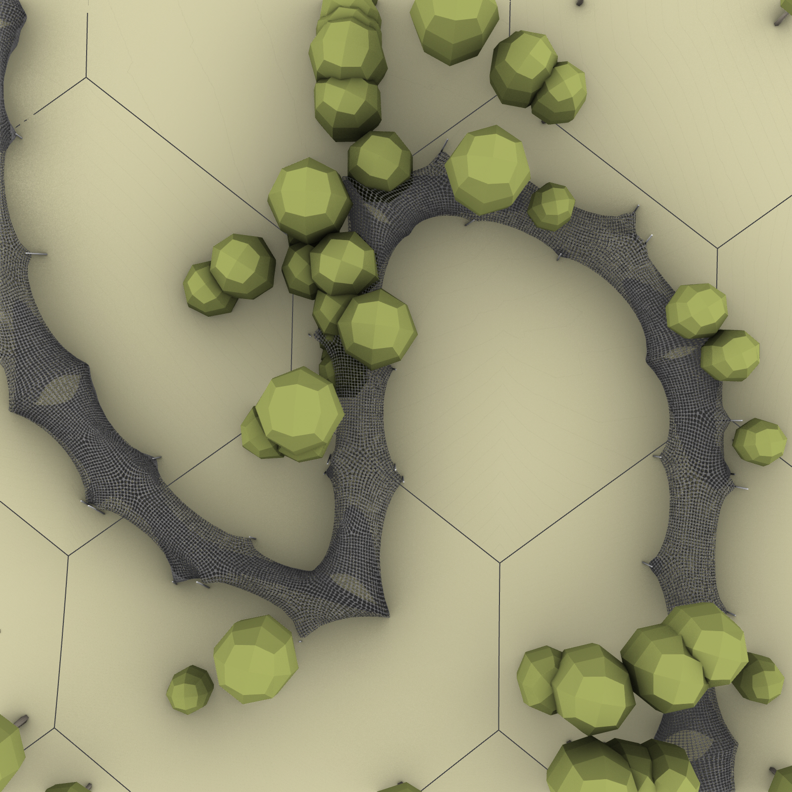
- Number of Trees; we scored each sector based on an “appropriate” tree density. not too many to restrict the flow of the cocoon through nor too few to be unable to provide much-needed shade. Our condition was 7-21 trees per sector which was about 2000 sq m. on average.
- Site Slope; the second condition was to score the sectors based on the topographical slope of the site. a maximum 10-degree slope was the condition to be met.
- Distance from the PoIs(Points of Interest); the third and last parameter in the scoring system was the distance of a sector from any given point of interest, an apparent one was the lake on the site, but based on different animals, across different seasons this might vary.
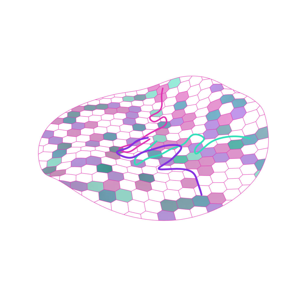
Step 02: Selecting the Sectors
Based on the scoring of the sectors, we can then map out the potential sectors with a minimum of 75% aggregate score.

Step 03: Mapping Journeys wrt the Permanent Galleries
Once we have the sectors with minimum criteria, we then move on to mapping multiple (03) journeys of similar aggregate interest value i.e. consisting of sectors which add up to a similar overall score.
Step 04: Shortest Route on the Terrain, Avoiding Trees
The mapped journey routes are then programmed against the following parameters sequentially:
- Shortest Walk from one sector to another.
- While maintaining a walkable 1:10 slope on the terrain.
- While also avoiding the trees in the way.
Step 05: Form Making
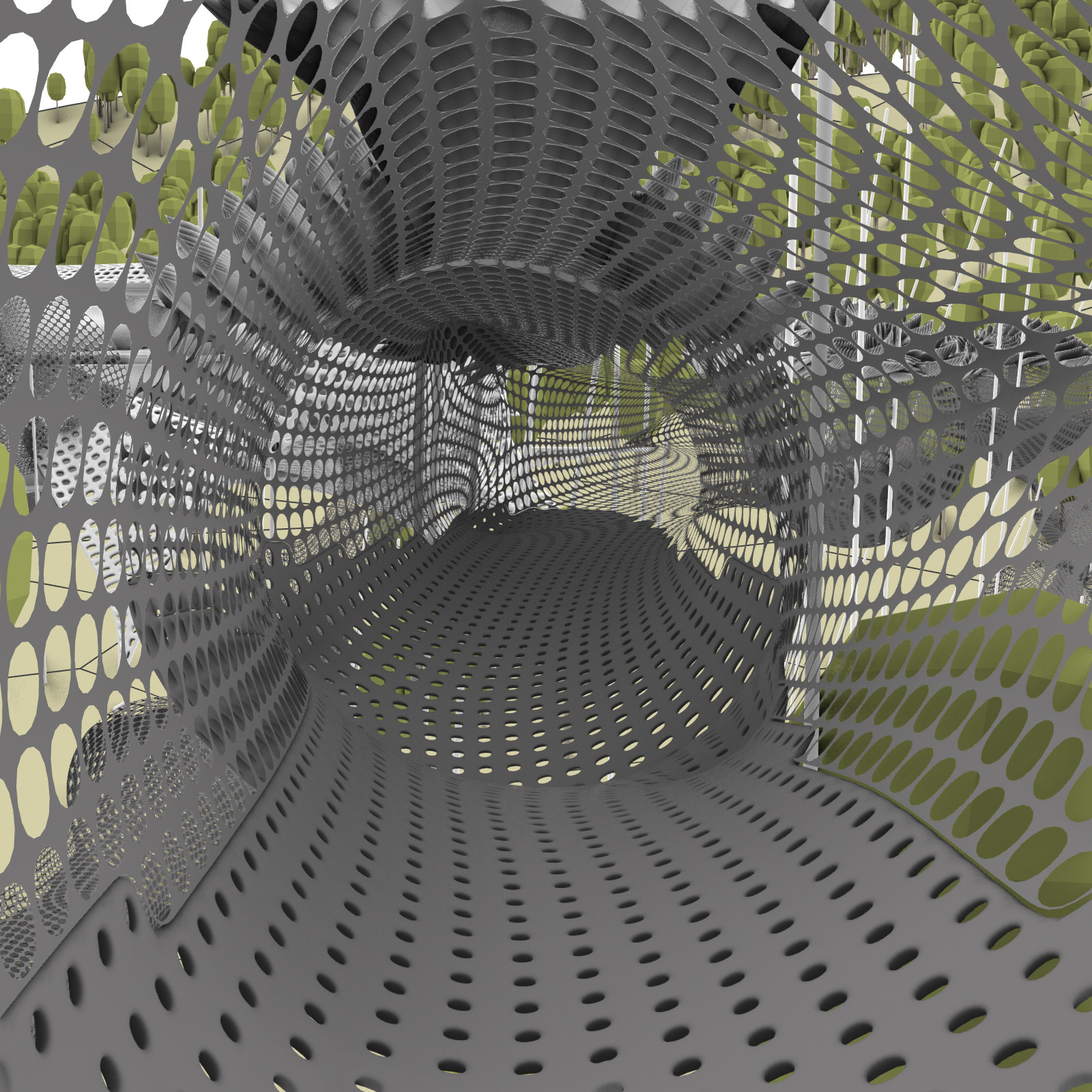
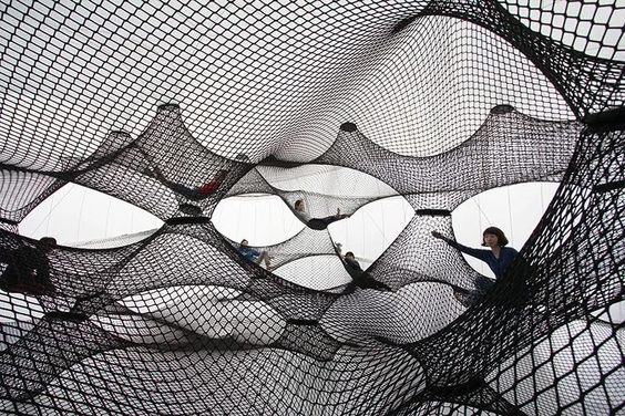
Once we have the journey routes tweaked, we then move on to transform these routes into the stretched fabric enclosures. stretching the spaces out for the users to indulge.
- The path curved is equally divided into 15m typical spans.
- A Primal surface is created around the curve, giving it a 5m clearance zone.
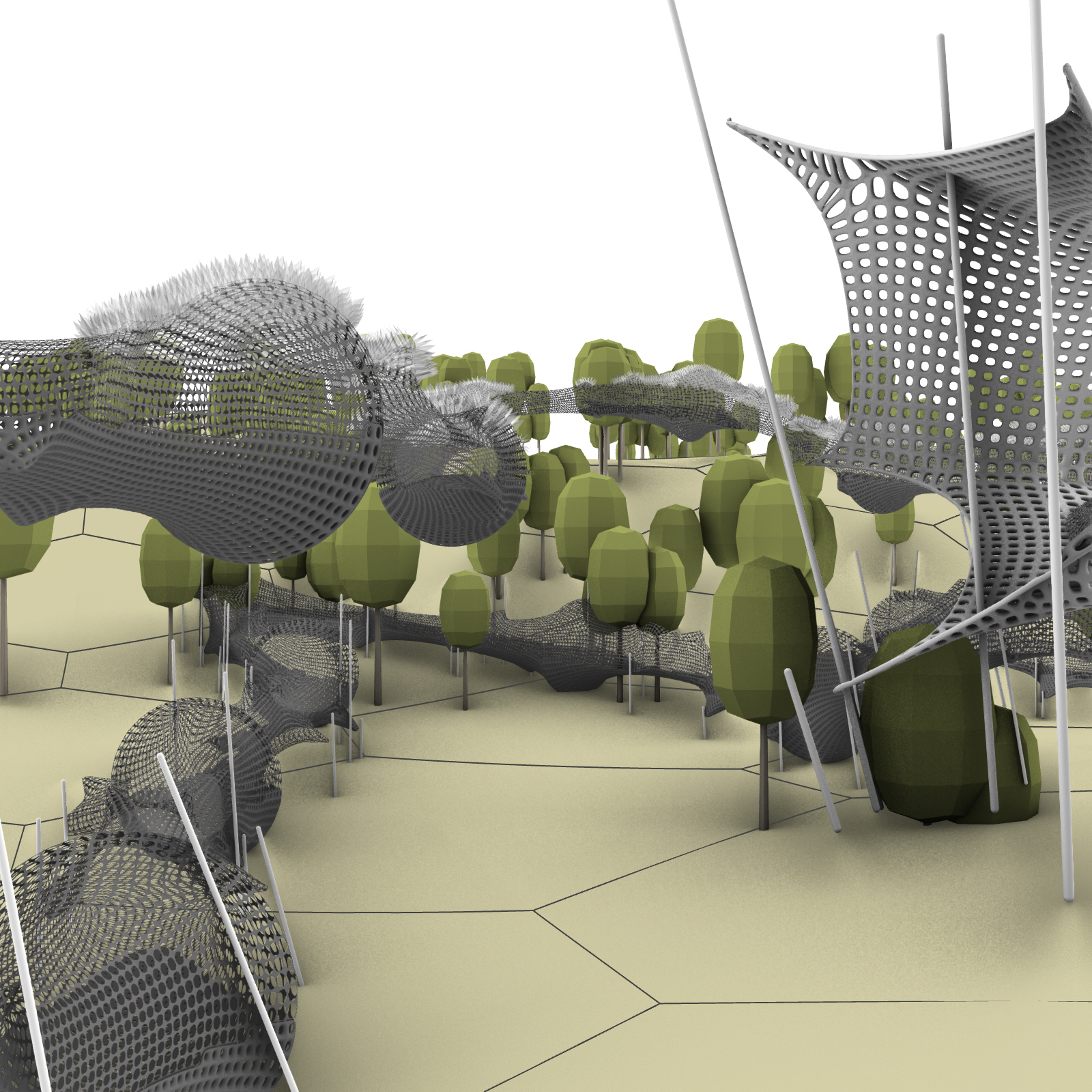
- The surface is then converted into an elementary mesh.
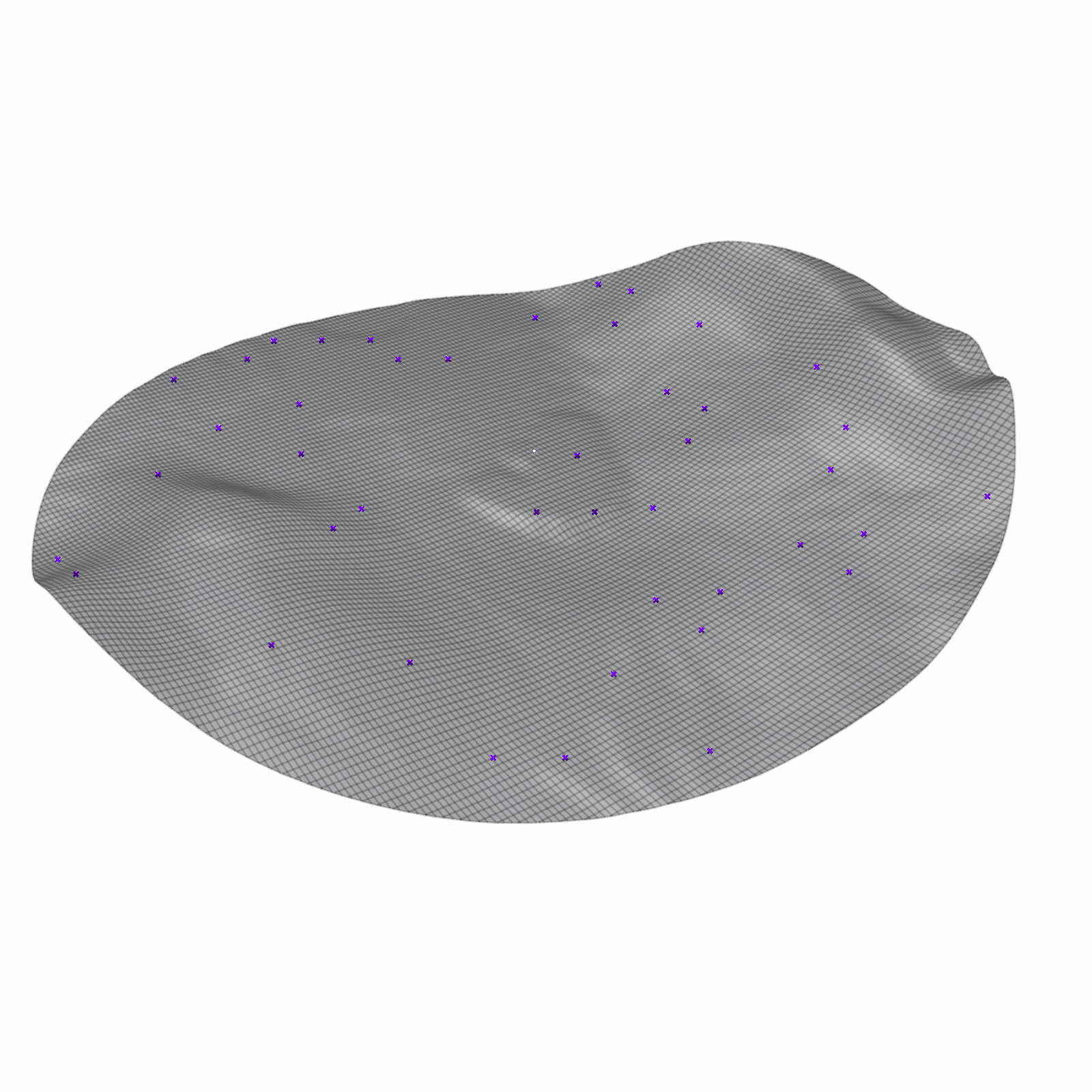
- Mesh goes through a tensile deformation anchored on distributed points and edge frames.
- Based on its relation with the ground, the mesh is split into lower and upper parts. Creating bassi for different typology treatments.
- Lower meshes which form the “ground” to walk on are denser, thicker weaved meshes while the sides and the top are more permeable. Allowing for views to and from the site.
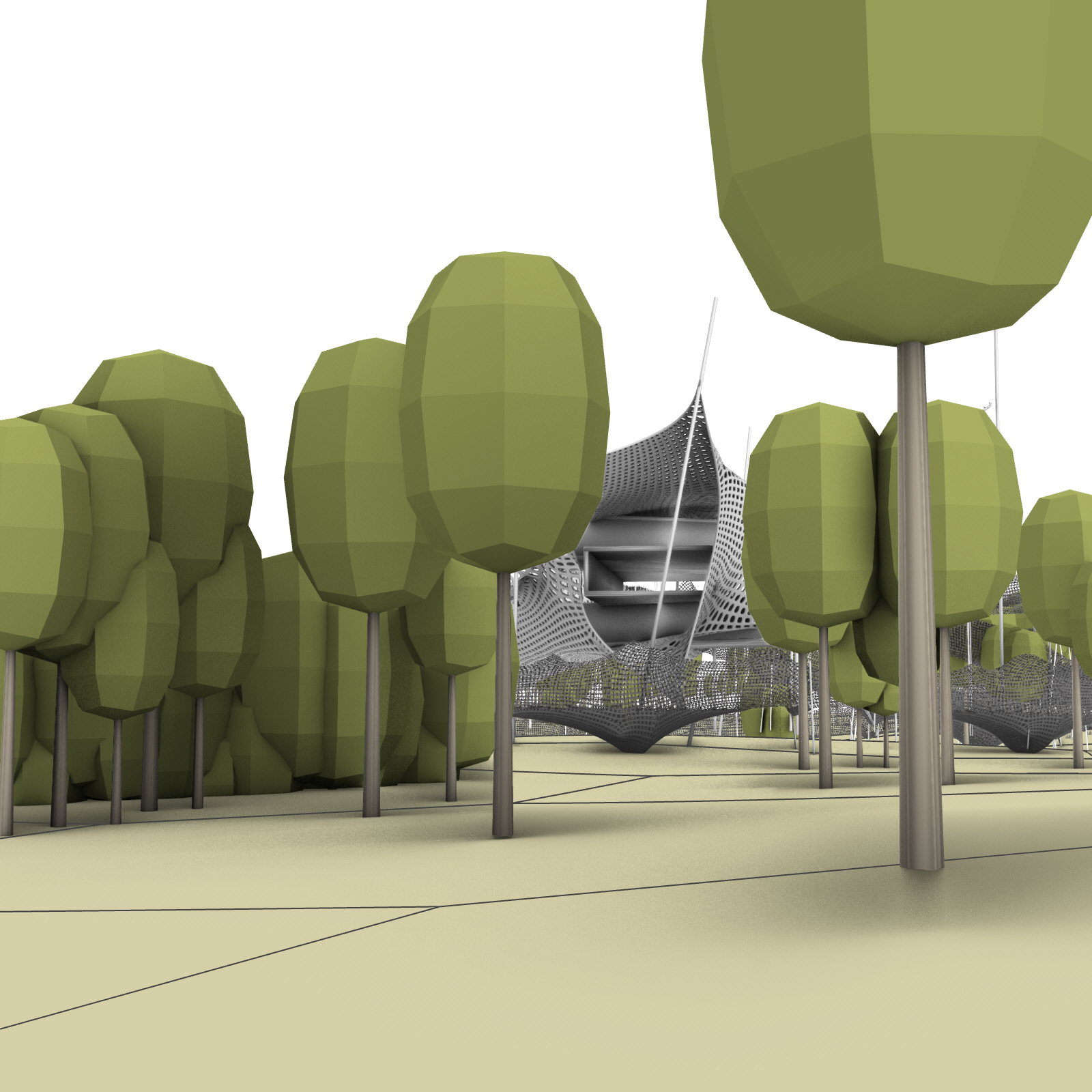
- Inflated membranes are panelized on the top meshes to protect from sun in the areas of minimal natural shade.
- Supports are then erected and the module is repeated to multiply the configuration.