The Master in City & Technology’s academic structure is based on IAAC’s innovative, learn-by-doing and design-through-research methodology which focuses on the development of interdisciplinary skills. During the Master in City & Technology students will have the opportunity to be part of a highly international group, including faculty members, researchers, and lecturers, in which they are encouraged to develop collective decision-making processes and materialize their project ideas.

Filters
Course

SKYWARD CONNECTIONS

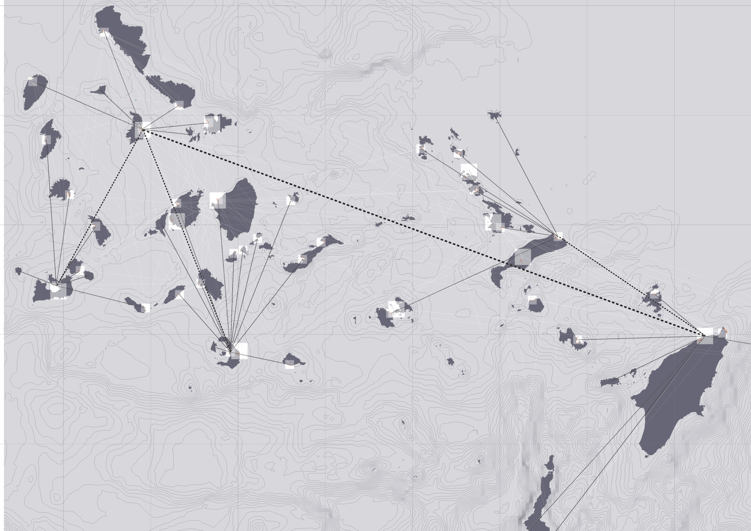
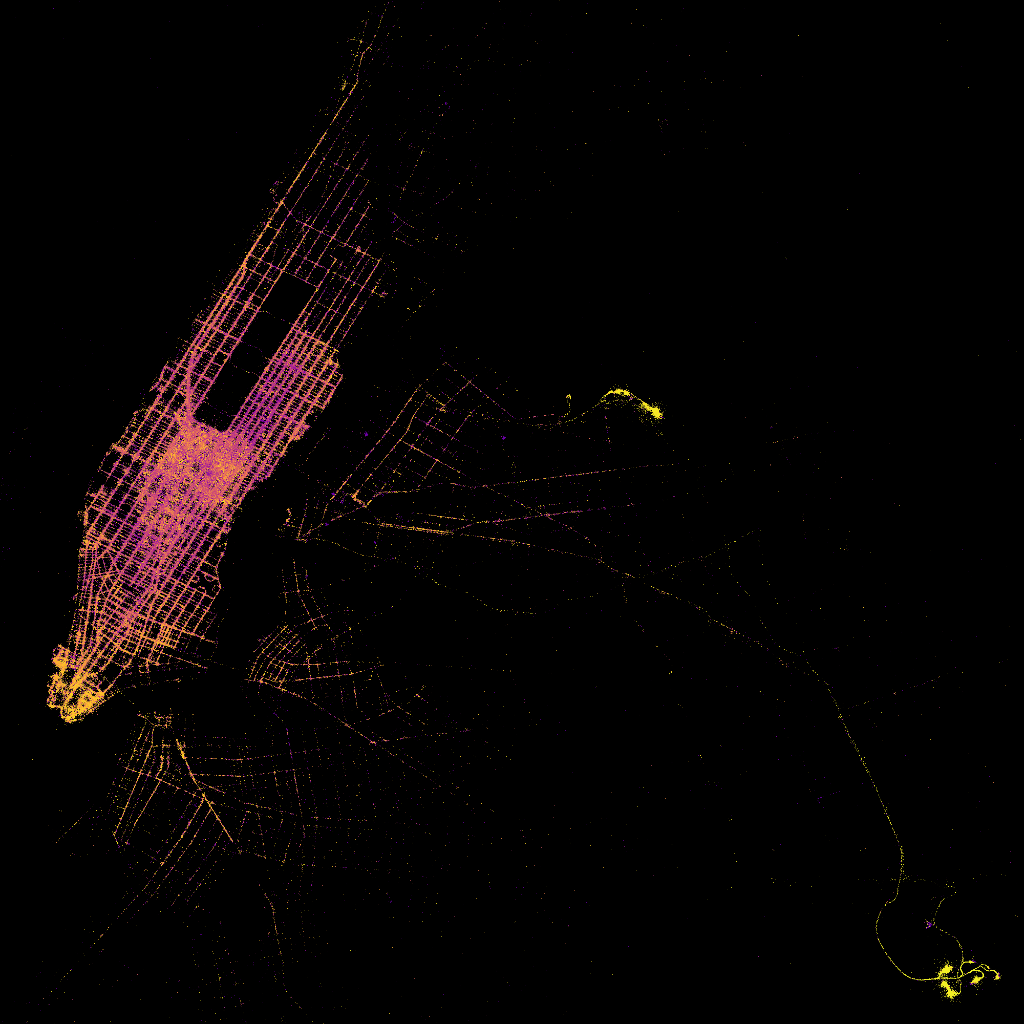
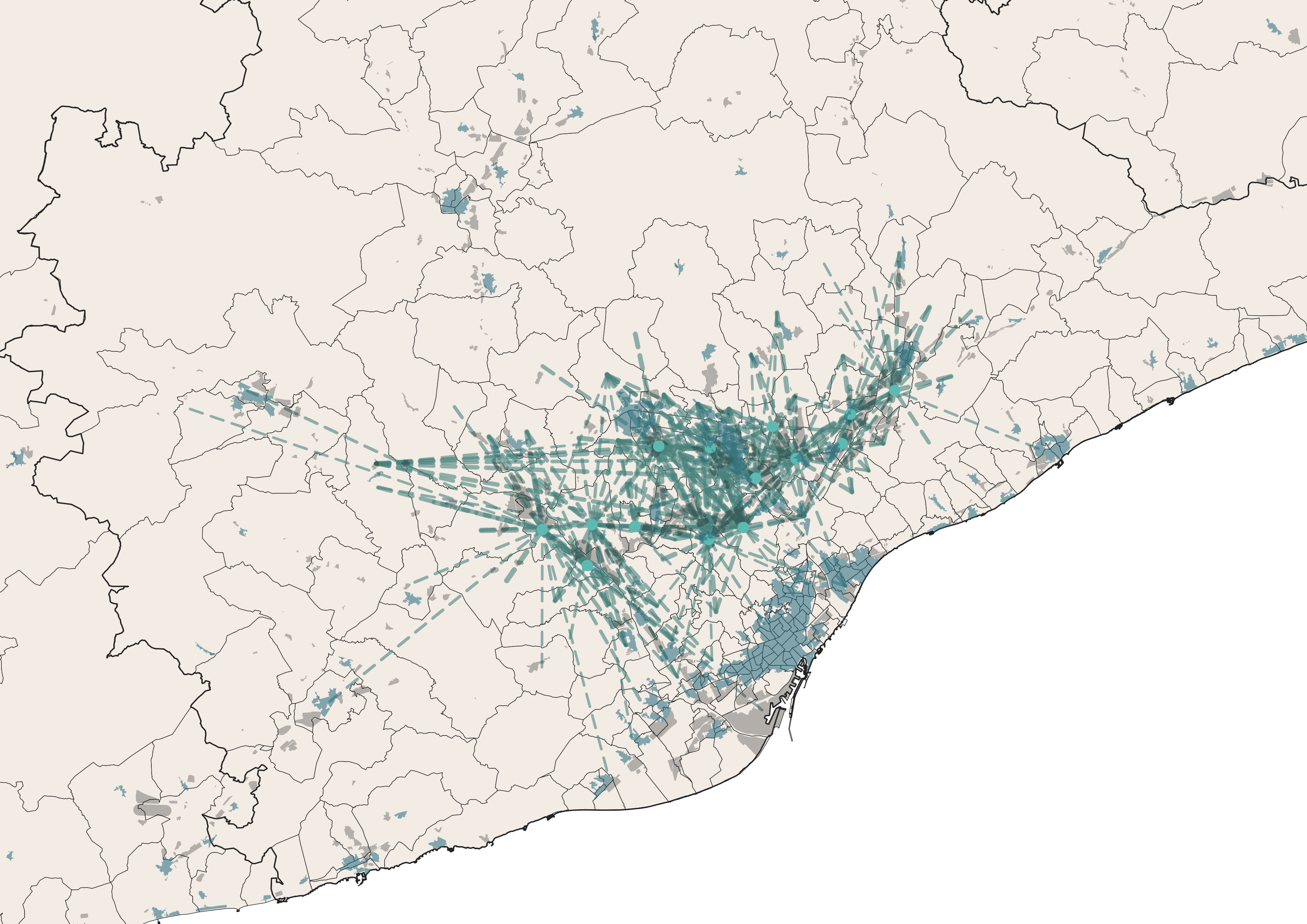
A Data-driven Approach of redefining the Accessibility of the Dispersed Urbanity of the Aegean Archipelago Accessibility is a multifaceted concept that expresses the case of access between two points in space. In the context of islands, accessibility is of utmost importance due to their inherent characteristics of isolation and small size. The Aegean Archipelago in … Read more

Street sounds of Barcelona

– 00– The project aims to analyze the sounds of streets in Barcelona, cluster them and compare. Firstly, a table of sound types evaluation is created. It consists of point data, network data and sound intensity data. – 01– The methodology and analysis of street segments is based on 1 dataset, that was combined using … Read more

????? • Rent • Proximities

The city of Mumbai, known as the financial and entertainment capital of India, has experienced a significant surge in housing prices and rents in recent years. The demand for residential properties in Mumbai has been steadily increasing due to factors such as population growth, urbanization, and the city’s thriving job market. In the midst of … Read more

Remote sensing of the urban sprawl’s pace of Melbourne

urban growth Melbourne

Starting in 2015 urban development spread beyond the administratively defined Melbourne metropolitan area, into Greater Geelong and the Shire of Mitchell. The Melbourne Metropolitan Region or Greater Melbourne comprises 31 Local Authority Governments (LGA, municipalities and shires) aggregated in 6 metropolitan partnerships. Two of them, Inner and Inner South-East allocate the metropolitan core. This project … Read more

Predicting Taxi Trip Duration in New York City Using Machine Learning

Machine learning has been applied to a wide range of domains, including transportation, to improve the accuracy of predictions and optimize systems. In the context of taxi services, predicting the trip duration is an essential task to optimize route planning and estimate arrival times. In this post, we present a machine learning approach using Python … Read more

Machine learning model to predict NYC cabs’ trip duration

Goal: to predict trip duration of NYC cabs using machine learning models. Tools: Python + Nympy + Pandas + Datetime + Plotly.express + Matplotlib + Math + Seaborn + Bokeh + Sklearn Stages of project: data cleaning, data analysis, data preparation, data testing, evaluating prediction accuracy. Data cleaning The first dataset visualization with splitting datasets … Read more

Data-Driven Rides

Machine Learning-based Analysis of NYC Cab Trip Duration “Data-Driven Rides” is an entry for the first MaCT Machine Learning Competition that hosted on Kaggle which involves predicting the duration of taxi rides in New York City. The dataset provided for this competition is based on the 2016 NYC Yellow Cab trip record dataset and the … Read more

1st Traditional IAAC MaCT ML Competition

#Objective #A Kaggle Competition to MaCT01 students to show their knowledge, designing an end-to-end machine learning project to predict the “Trip Duration” of NYC Taxi trips. #Workflow #First of all a workflow hast do be developed, which represents a classic approach for training machine learning models, analysing the provided training data provided by the submission, … Read more

Mumbai Dabbawala

Do you nip out to get your lunch from your favourite café, or perhaps use the Uber Eats app to get your lunch delivered to your office? In India, lunch is a whole different ball game. It’s people-powered – made at home that morning and delivered straight to you, all absent of any technology in time. … Read more

The Scenic Route

Finding the greenest bicycle path that connects all the parks in Barcelona The shortest walk connecting all the parks was computed based on the road map. The existing bicycle lane does not connect all the parks in Barcelona. Hence, a second shortest path was created by pulling points from the road map to the bicycle … Read more

Safer City Streets: Urban Mobility in Barcelona

Introduction As of 2021, the city of Barcelona has around 3.8 million vehicles (from cars to buses, cars, vans, etc.) circulating on its streets. Despite the efforts of the city council to better balance the motor urban mobility with the pedestrian flow throughout an urbanism model that puts people at the center, street accidents continue … Read more