
IAAC’s Master in City & Technology (1 or 2-year program) is a unique program oriented towards redefining the analysis, planning, and design of twenty-first-century cities and beyond. The program offers expertise in the design of digitally enhanced, ecological and human-centered urban environments by intersecting the disciplines of urbanism and data science. Taking place in Barcelona, the capital of urbanism, the Master in City & Technology is training the professionals that city administrations, governments, industries, and communities need, to transform the urban environment in the era of big data.
CLEAN UP THE NOISY CITY!

Through this workshop, we developed “Clean up the Noisy City,” an educational and interactive game designed to raise children’s awareness of urban soundscapes. In this engaging experience, players take on the role of city problem-solvers, working together to identify, assess, and mitigate disruptive noises using creative solutions. The game is played through a structured yet … Read more
Sant Antoni Passport
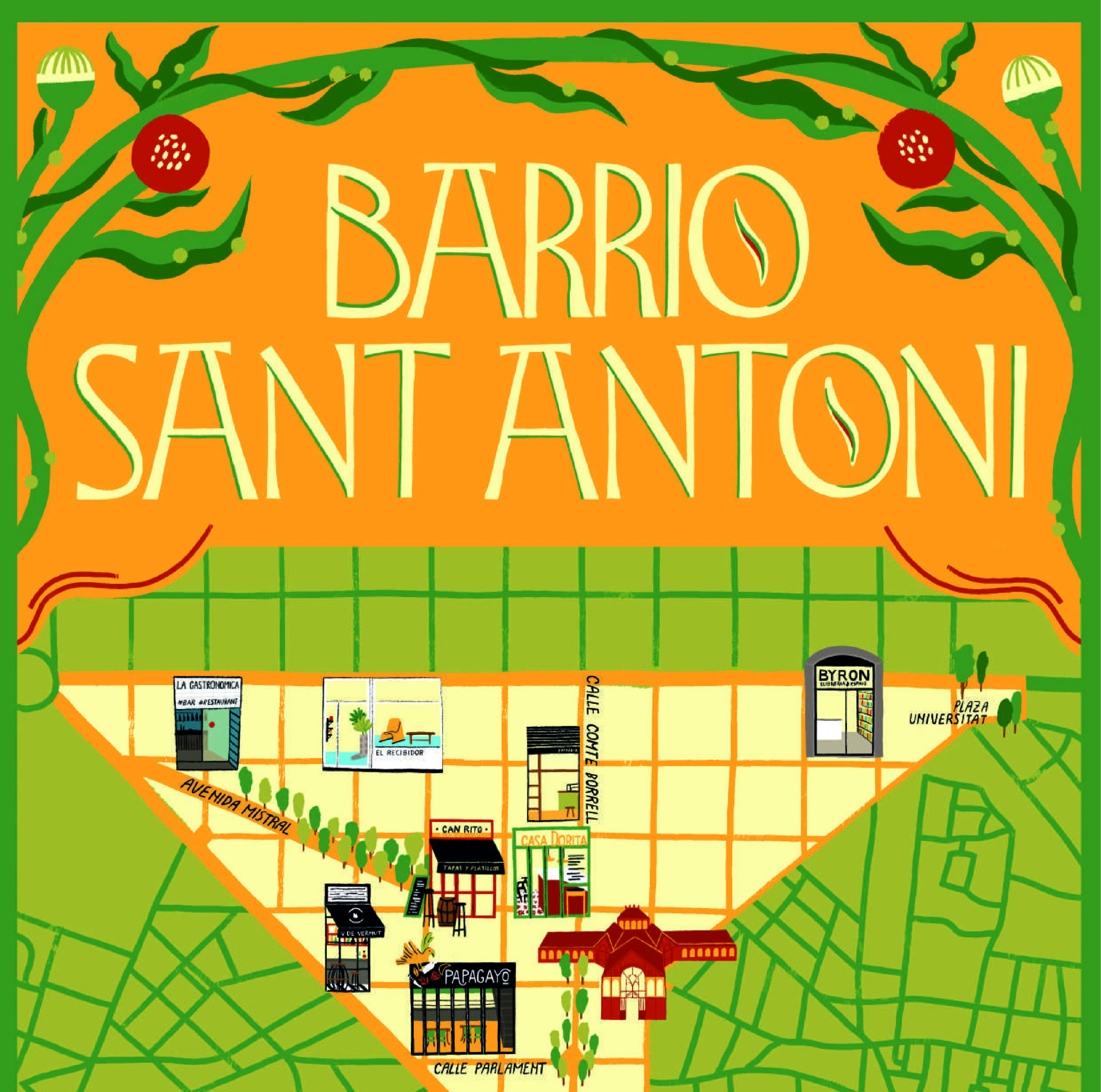
Urban spaces are not just places to live and work—they are playgrounds for social interaction, historical storytelling, and cultural engagement. As part of the IAAC’s Serious Games Seminar, our team explored Sant Antoni, Barcelona, to design playful interventions that connect the community to its past, present, and future. Our approach combined game design with urban … Read more
consans
This term, we have been focusing on understanding and designing public spaces in the Sants neighborhood of Barcelona. Sants has a unique identity shaped by its long-standing tradition of neighborhood cooperation and pride in its working-class roots, but has faced civic disengagement in recent years. In the studio, our objective has been to leverage public … Read more
Quaker

In the field of urban planning, engaging citizens and stakeholders in the increasingly complex social and environmental issues of the built environment is one of the major challenges. As a way of looking to attract, persuade, and foster empathy, Quaker can be a potent tool in connecting the community of Poblenou with our project and … Read more
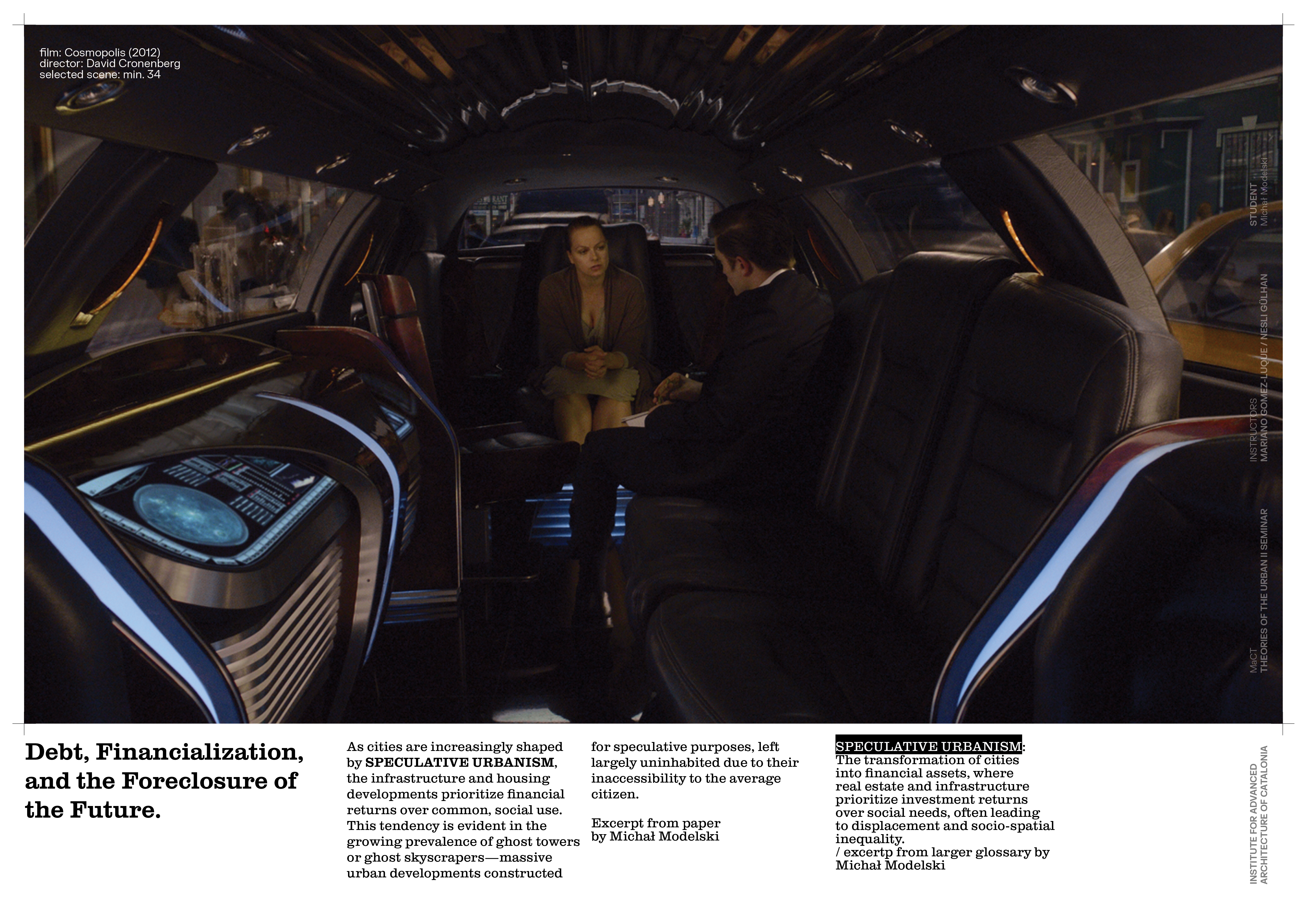
Living In Crisis
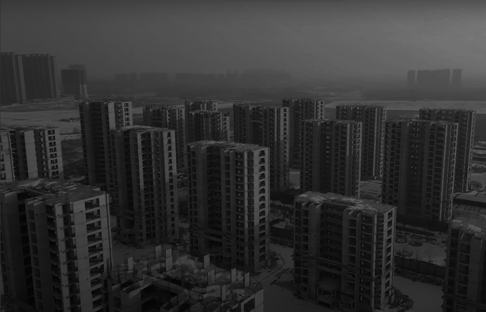
This study proposes a conceptual framework for examining contemporary housing conditions through the lens of 21st-century urbanism. Drawing from a selection of influential texts, it systematically identifies and synthesizes key theoretical concepts into a set of recurring idea clusters. These clusters are then distilled into concise statements that illuminate core issues shaping the current housing … Read more
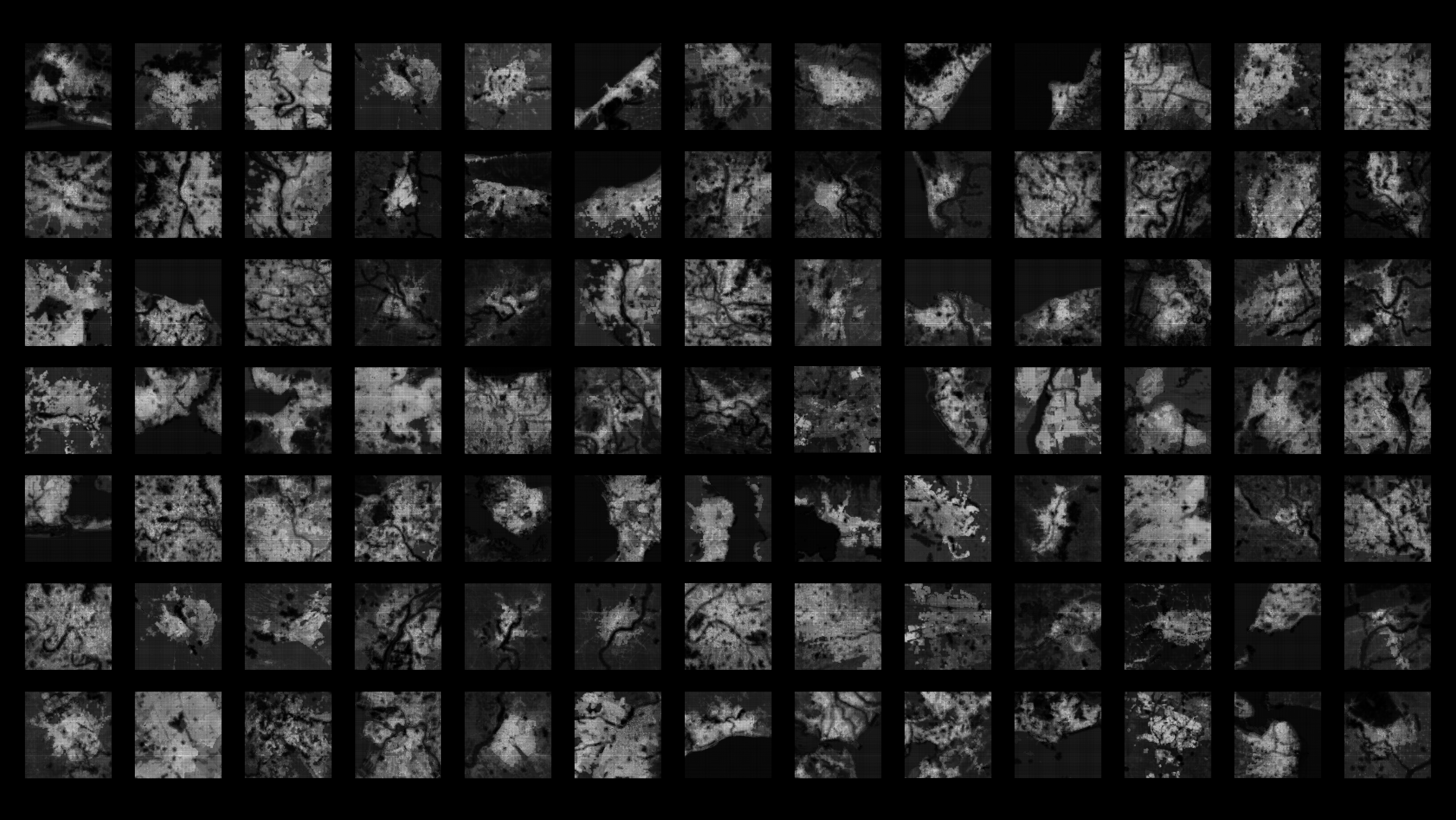
Urbanism Around Landslides_A Remote Sensing Approach – ThesisResearch_01
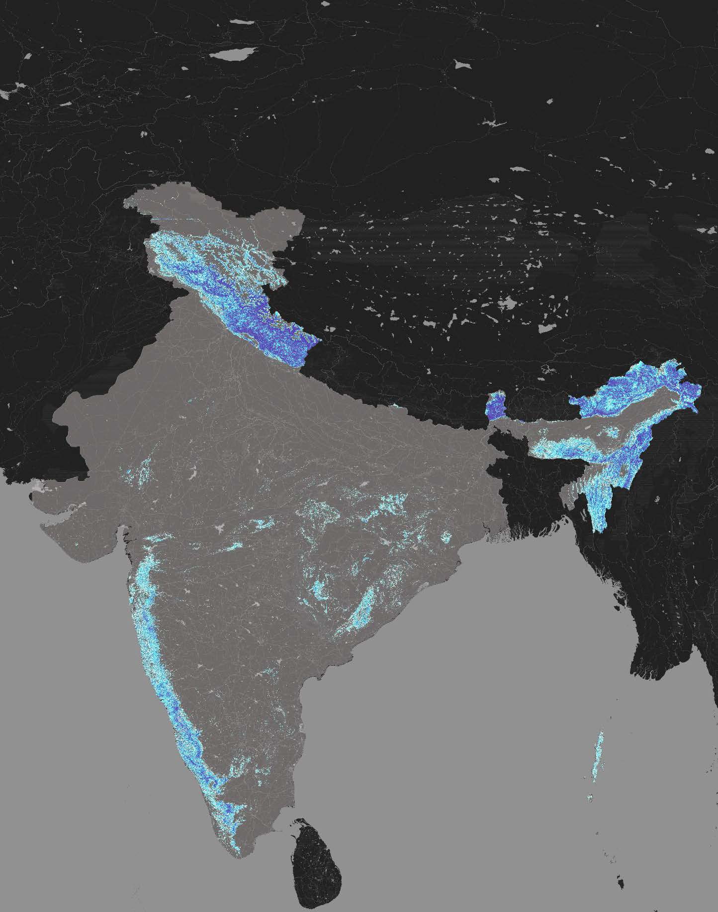
Introduction Landslides in certain regions of India, have been a frequent occurrence, and are further exacerbated by its unique geographic and climatic conditions. Between 2015 and 2022, over 3,700 major landslides were recorded, with 12.6% of the country’s land area prone to such disasters. The regions most affected include the northern states of Himachal Pradesh, … Read more
DEMOCRATIZING CREDIT: A New Paradigm in Lending
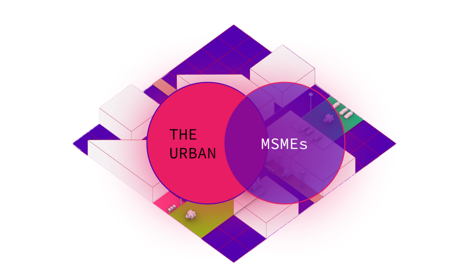
The project envisions the use of novel data collection strategies for the purpose of increasing access to formal credit for MSMEs in the F&B Space Across the globe, cities face a pivotal challenge: unlocking the potential of their micro, small, and medium enterprises (MSMEs) to drive both urban transformation and national economic growth. These enterprises, often comprising over 90% of businesses in developing … Read more
MOBILITY INJUSTICE
URBAN WAYFINDING FOR THE BLIND Understanding how visually impaired or blind individuals navigate urban environments reveals significant challenges tied to mobility injustice across various scales. This issue extends beyond individual obstacles, encompassing systemic gaps in urban design that fail to accommodate diverse needs. My thesis delves into these injustices, exploring the barriers that hinder equitable … Read more
Women+ and Urban Safety: Qualitative Data and Literature

How do we evaluate the current paradigms of designed public spaces to test the perceptions of safety of women+ in India such that it aids urban designers to make free movement of women+ easier in India, especially Delhi? Overview Women+ and Urban Safety is a research to find answers to the question of “how do … Read more
Informal Eyes in the Street – T1: Data Gathering
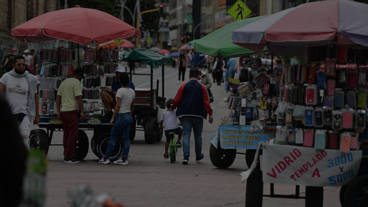
Context Bogota is the capital of Colombia. Both the perception of unsafety of its inhabitants as well as the amount of urban crime have been rising over the last years, with over 70% of the population feeling unsafe, and more than 120 thousand theft victims in 2023. The local government response to this has mainly … Read more
Heat Archipelagos
Rising heat is an increasingly critical global condition driven by climate change, urbanization, and deforestation. Average global temperatures have climbed due to greenhouse gas emissions, leading to more frequent and intense heatwaves that threaten ecosystems, economies, and public health. Urban areas, in particular, experience exacerbated effects due to the urban heat island phenomenon, where concrete, … Read more
