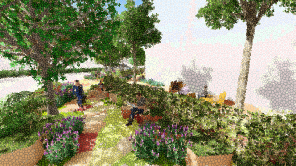
The Master in City & Technology’s academic structure is based on IAAC’s innovative, learn-by-doing and design-through-research methodology which focuses on the development of interdisciplinary skills. During the Master in City & Technology students will have the opportunity to be part of a highly international group, including faculty members, researchers, and lecturers, in which they are encouraged to develop collective decision-making processes and materialize their project ideas.

Filters
Course

Promised Land

Mesh representation of MIDI

Mapping America’s Genrescape Promised Land, Chuck Berry’s early representation of modern rock and roll, blurs racialized difference in genre origin, fueling the hybridization of genre categorizes, resulting in America’s current rich music tapestry. MIDI data correlated to synaesthetic representations of color is crystalized and in a dense three-dimensional mesh and place qualities are correlated to … Read more

Counting and displaying geographical information

Introduction Grasshopper, renowned for its prowess in visualization, presents a unique landscape of opportunities for those eager to dive deep into the realm of geographical information. This blog post presents the start of my journey with Grasshopper, highlighting its potential as well as the challenges and learning curves it presents. Objective: Gaining Confidence with Grasshopper … Read more

Visualization of Complex Innovation Data using Python

Innovation is a buzzword these days, and everyone seems to be talking about it. However, truly understanding it is a different ball game. Take the Global Innovation Index by the World Intellectual Property Organization (WIPO), for example. It’s a massive framework that pulls data from top-tier organizations worldwide, scoring countries on 100+ indicators. It’s a … Read more

Cities in Motion

Bogota Public Transport from GTFS

The General Transit Feed Specification (GTFS) is a standardized format designed for the distribution of public transport information globally. This format facilitates the integration of public transportation systems in cities worldwide with popular route planning platforms like Citymapper, Waze, or Moovit. By doing so, it enables users to access information on transport availability and plan … Read more

Can inequality of opportunity be mapped?

An exercise in visually corelating data. Introduction The Swedish educational system is based on merit. Students have to compete for places by means of their average grades. The competition is fierce, especially in large cities such as Stockholm. This project forms an attempt to showcase a possible correlation between the median acceptance grades of schools … Read more

Potential Building Stock in need of Renovation or Demolition

The BCN Building Stock project aims to assess the condition of the building stock in Barcelona (BCN) and identify potential buildings that require renovation or demolition. This analysis is crucial for urban planning and sustainable development initiatives, as it provides insights into the state of the city’s building stock. By leveraging data analysis techniques and … Read more

SKYWARD CONNECTIONS

A Data-driven Approach of redefining the Accessibility of the Dispersed Urbanity of the Aegean Archipelago Accessibility is a multifaceted concept that expresses the case of access between two points in space. In the context of islands, accessibility is of utmost importance due to their inherent characteristics of isolation and small size. The Aegean Archipelago in … Read more

Construction & Demolition Waste Transportation Improvements, Barcelona

22@, an ongoing project in Poblenou, Barcelona aims to promote sustainable development and enhance the quality of life for its residents. However, one of the current challenges faced by the project is the significant noise and air pollution caused by the transportation of construction and demolition waste (CDW) from construction sites to landfills, which adversely … Read more

GENDERED GEOGRAPHIES

Navigating Urban Realities through Women’s Perception of Safety Cities all over the world are being quantified and rated in terms of their livability and life quality for better understanding of citizen satisfaction.  Safety, including both the tangible aspects and the subjective perception of safety, is a critical component in assessing urban life quality. According to … Read more

The 3-30-300 Rule

TRANSFORMING CITIES INTO URBAN FORESTS This principle, proposed by Cecil Konijnendijk, highlights the significant role played by urban forests and other forms of urban nature in promoting our health, well-being, and resilience to climate change. It acknowledges the need to consider various aspects of urban forests to achieve success. It also emphasizes the importance of … Read more

20 minute neighborhoods in Melbourne

-Problem statement- The extensive sprawl of Melbourne and the affordability challenges have led to a situation where purchasing a home in the central area is increasingly difficult. This situation urges residents to seek housing options in the outskirts, as a result consequently contributing to the city’s expanding boundaries. -Aim of the project- In the city … Read more

Green Printing

Urban Green Spaces are critical urban infrastructure – equally important to how our city functions as transport networks, and particularly vital to the wellbeing of our community. Urban greening supports Melbourne’s economy, providing cooling and amenity which supports the pedestrian economy and reduces operating costs for local businesses. Melbourne is encouraging more innovative methods for … Read more

Urban mining in the city of pre-cast concrete

Singapore, a quickly developing city-state is running out of land and linear expansion with new housing will soon no longer be an option. The project strategically targets public housing as a place of densification and a source of urban mining, aiming to solve the problem of upcoming precast concrete waste. Therefore a circular micro-district design … Read more

Built Heritage vs Real Estate Market. The Barcelona case

python analysis BCN

Main question. How built heritage affects real estate market in European cities? Hypothesis Let’s look at this question on the example of Barcelona. Let’s single out the city neighborhoods (barrios) where historical buildings are located, and analyze the ratio of average real estate prices to them, in particular, the sale prices of apartments and houses. … Read more

Street sounds of Barcelona

– 00– The project aims to analyze the sounds of streets in Barcelona, cluster them and compare. Firstly, a table of sound types evaluation is created. It consists of point data, network data and sound intensity data. – 01– The methodology and analysis of street segments is based on 1 dataset, that was combined using … Read more