IAAC’s Master in City & Technology (1 or 2-year program) is a unique program oriented towards redefining the analysis, planning, and design of twenty-first-century cities and beyond. The program offers expertise in the design of digitally enhanced, ecological and human-centered urban environments by intersecting the disciplines of urbanism and data science. Taking place in Barcelona, the capital of urbanism, the Master in City & Technology is training the professionals that city administrations, governments, industries, and communities need, to transform the urban environment in the era of big data.


Filters
Course

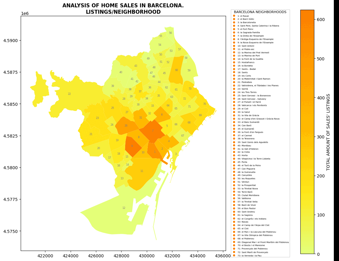
GenCity – An intervention enabler for Co-creating Urban Designs

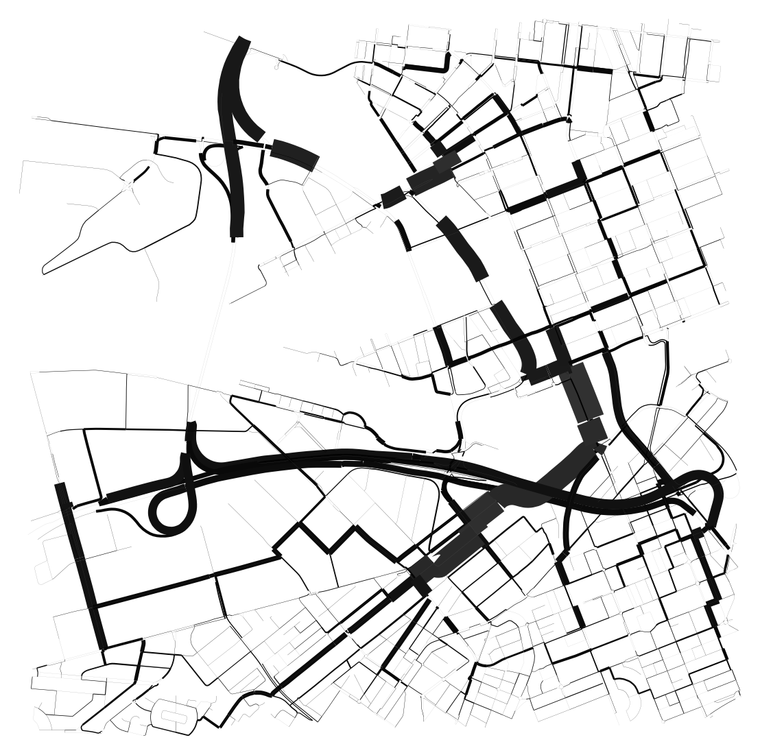
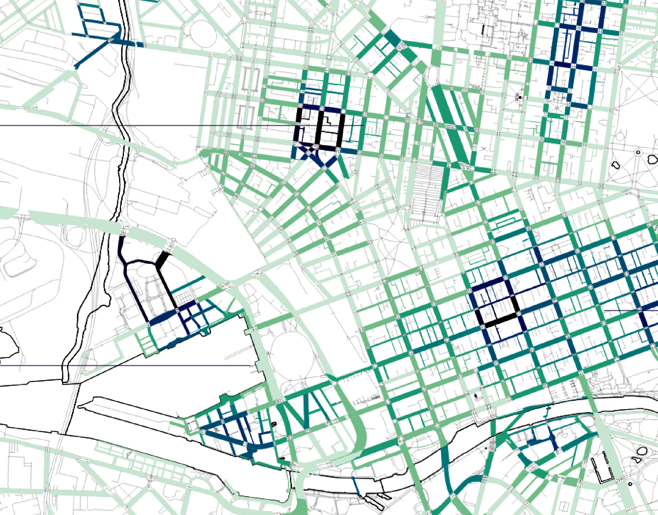
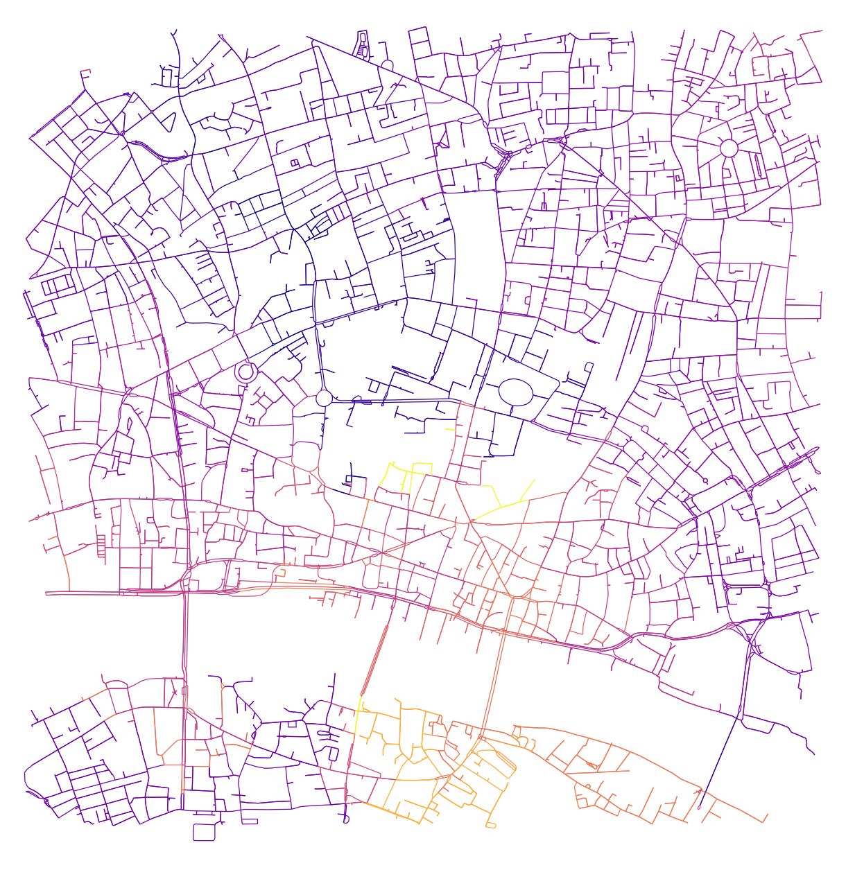
Alejandro Aravena, renowned for his role in facilitating the recovery of a city struck by an earthquake and a tsunami, asserts that Participatory design transcends mere inclusivity and offers enhanced efficiency. Despite recognizing the significance of public participation in urban planning, we delve into the persisting factors that hinder its optimal efficiency. Conventional methods may … Read more

Green Printing

Urban Green Spaces are critical urban infrastructure – equally important to how our city functions as transport networks, and particularly vital to the wellbeing of our community. Urban greening supports Melbourne’s economy, providing cooling and amenity which supports the pedestrian economy and reduces operating costs for local businesses. Melbourne is encouraging more innovative methods for … Read more

Built Heritage vs Real Estate Market. The Barcelona case

python analysis BCN

Main question. How built heritage affects real estate market in European cities? Hypothesis Let’s look at this question on the example of Barcelona. Let’s single out the city neighborhoods (barrios) where historical buildings are located, and analyze the ratio of average real estate prices to them, in particular, the sale prices of apartments and houses. … Read more

Street sounds of Barcelona

– 00– The project aims to analyze the sounds of streets in Barcelona, cluster them and compare. Firstly, a table of sound types evaluation is created. It consists of point data, network data and sound intensity data. – 01– The methodology and analysis of street segments is based on 1 dataset, that was combined using … Read more

The Heat Gap

This project explores the relationship between urban heat and mental health in a city using clustering analysis. Four distinct clusters were identified, revealing patterns related to population percentages with mental health problems, urban heat levels, and proximity to industrial areas. Additionally, the study examines the association between urban heat, housing stress, and access to natural … Read more

????? • Rent • Proximities

The city of Mumbai, known as the financial and entertainment capital of India, has experienced a significant surge in housing prices and rents in recent years. The demand for residential properties in Mumbai has been steadily increasing due to factors such as population growth, urbanization, and the city’s thriving job market. In the midst of … Read more

Predicting the future densification Helsinki along its former transportation infrastructure.

OVER THE NEXT FEW DACADES HELSINKI EXPECTS TO ADD AROUND 250.000 NEW RESIDENTS IN 30-40KM OF TRANSFORMED MOTORWAY – LIKE HIGHWAYS PROJECT DESCRIPTION: In the future, a transition from highways and roadways to boulevards is anticipated due to a projected decrease in the number of cars. This shift is expected to address several issues commonly … Read more

Melbourne Meltdown X Space Syntax

The project attempts to understand correlations between several relevant factors of today where it aims at identifying the correlations between the mental health data of the city, urban heat island effect, land surface temperature, population, green areas, total neighborhood area, green ratio per neighborhood, NDVI values, distances in 500m to the green spaces, distances in … Read more

Senseable Walks for Melbourne

OPTIMIZING THE EXISTING WALKABILITY INDEX Urban design plays a pivotal role in shaping the livability of a city, and walkability is a crucial aspect that directly impacts its residents’ quality of life. The City of Melbourne has developed a Walkability Index. This project aims at optimizing the existing framework by integrating key parameters related to … Read more

P a r c o     d e     M ä

Parco de mä was developed by Matteo Piccoloto, Yohan Wadia, Amélie Roy, Lisa Guglielmi, Pushkar Runwal, Koen Kool, Juan Felipe Casses, Dimitris Athanasiou, with the support of trainers from the Vienna University of Economics and Business, the Institute for Advanced Architecture of Catalonia, the University of Genoa and ALDA, during the Green Skills for Cities … Read more

Remote sensing of the urban sprawl’s pace of Melbourne

urban growth Melbourne

Starting in 2015 urban development spread beyond the administratively defined Melbourne metropolitan area, into Greater Geelong and the Shire of Mitchell. The Melbourne Metropolitan Region or Greater Melbourne comprises 31 Local Authority Governments (LGA, municipalities and shires) aggregated in 6 metropolitan partnerships. Two of them, Inner and Inner South-East allocate the metropolitan core. This project … Read more

4-DIMENSIONAL URBAN ECOLOGICAL LIVING STRATEGY

ABSTRACT With a focus on Spain, this study explores the potential of urban-ecological corridors and bio-cultural landscapes in enhancing wildfire resilience and reversing biodiversity loss in the Mediterranean region. It proposes a 4-dimensional urban-ecological living strategy that integrates burnt areas, ecological connectivity, and sustainable agriculture for improved adaptive resilience. The study employs a multidisciplinary approach, … Read more